Booklet: Green Infrastructure Planning for the Coast – A Primer for Local Decision-Making

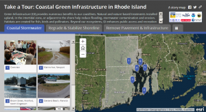
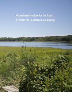
This booklet provides municipal officials, staff, and board members with insights on implementing green infrastructure projects, with special attention to coastal areas.  It answers ten key questions that arose during the development of conceptual designs for RI GRIP’s three coastal green infrastructure pilot projects. The goal is to build a common foundation from which to move ahead with green infrastructure as a valued tool for coastal communities.


The booklet addresses these key questions are:

  1. How is green infrastructure applied on the coast?
  2. What are the benefits of implementing coastal green infrastructure?
  3. What is an integrated design process and how does it enhance outcomes?
  4. What are some key design considerations?
  5. Why is planning for maintenance critical to the design process?
  6. How do you start to frame decision making about green infrastructure?
  7. What are the considerations for appropriate plant selection?
  8. How do municipalities fund green infrastructure?
  9. What are the barriers to adopting green infrastructure? what are the solutions?
  10. Where can i get additional information and support?

Municipal Conceptual Designs for Green Infrastructure

The approaches and lessons from three pilot projects are applicable to other communities facing similar coastal issues related to stormwater and flooding. The GRIP team used an integrated design process for each case study, which brought together a multidisciplinary group of stakeholders and experts to share their knowledge and experience. The process ensured that multiple goals, functions, and benefits were considered and included in the final designs.

  • Oakland Beach, Warwick, RI
    • Challenge: Oakland Beach is a recreational, historic, and economic hub for Warwick, attracting numerous swimmers and fisherman. The site has impaired water quality and is vulnerable to coastal flooding, storm surge, and sea level rise. Stormwater runoff from dense development results in frequent beach closures that raise public health, safety, and economic concerns.
    • Solution: While larger-scale projects were considered, the GRIP team focused on shorter-term changes that may build support for future retrofits throughout the watershed. Proposed improvements include a rain garden bioretention system, dune enhancement, and installation of solar ‘Big Belly’ trash receptacles to reduce pollution to the Bay.
  • Marine Avenue Cliff Walk Access, Newport, RI
    • Challenge: Marine Avenue is a popular public access route to the historic Cliff Walk. During storms, runoff from lawns and roads carries nutrients, bacteria, and sediment into the nearby cove. The runoff also erodes the path to the Cliff Walk.
    • Solution: A bioretention area that slows flow and intercepts, filters, and infiltrates runoff was designed. The design uses native wildflower and grass mixes instead of stone and woody vegetation to reduce maintenance burden and enhance aesthetics and habitat values.
  • Brown Street Parking Lot, Wickford, North Kingstown, RI
    • Challenge: The parking lot in Wickford Village supports the local economy and recreation. It is vulnerable to flooding during extreme high tides, rain events and coastal storms. Untreated stormwater drains from the parking lot to the harbor; the substrate is likely not suitable for infiltration. Sea level rise and increased storm intensity will exacerbate these issues. The parking lot has multiple owners, both public and private.
    • Solution: This location offers no easy solution. The GRIP team considered short- and medium-term options (20-year design life) while long-term options are explored. The team recommended regrading selected low areas, modifying catch basins and outlet pipes, and installing elements of green infrastructure where feasible. The design also enhances access to the waterfront and public space  while maintaining the parking lot’s parking capacity.

Interactive Map: Tour of Coastal Green Infrastructure

This interactive map shows existing green infrastructure installations seen in Rhode Island’s coastal municipalities. Projects demonstrate approaches for managing stormwater, reducing erosion, and improving water quality. Techniques include rain gardens, bioswales, shoreline regarding, pavement removal, and wetland restoration, among others. Do you have other examples?  Please let us know and we will include them in our interactive map.

Maintenance Training

RI GRIP conducted maintenance training sessions with staff from two coastal municipalities. Working with those responsible for design and maintenance, these sessions identified issues related to maintaining existing green infrastructure installations. These learnings, illustrated in this presentation, provide insight to best practices for retrofits, future designs, and maintenance plans.

Key takeaways:

  • Design green infrastructure systems with maintenance in mind.
  • Maintenance personnel must be included in the design phase to ensure the long-term success of projects.
  • Maintenance staff need to understand how the system is supposed to work in order to effectively maintain it. Providing a list of maintenance tasks, without context, is not effective.
  • Green infrastructure designs with grass and soil filters can be as effective for water quality treatment as shrubs or perennials, and easier for municipalities to effectively maintain.
  • Anticipate that plants in coastal areas will be sprayed or inundated with salt water and sand. Use appropriate coastal-tolerant plants.
  • Green infrastructure plantings will evolve over time – plan for this change.
  • Basic operation and maintenance checklists, developed by municipal staff, can be used for future inspection and maintenance.

Stakeholder Engagement Design Workshops

Two design charrettes aimed to identify existing problems and possible design solutions for Oakland Beach in Warwick and the Brown Street parking lot in Wickford, North Kingstown. Practitioners from various backgrounds including landscape architecture, stormwater management, coastal habitat and geology, and regulation, as well as municipal leaders and staff from planning, construction, and maintenance departments exchanged ideas, approaches, and technical expertise to make critical design decisions. A hands-on exercise used green infrastructure ‘game pieces’ to overlay on large maps to visualize and evaluate different design alternatives.These facilitated meetings can be useful to other communities to engage stakeholders.   

Landscape Architecture Studio Projects

URI Landscape Architecture students proposed conceptual designs to help municipalities address sea level rise and flooding in partnership with RI GRIP. Sites included Oakland Beach in Warwick, King and Spencer Parks in Newport, and the Brown Street parking lot in Wickford, North Kingstown. Students participated in listening sessions with local constituents to gain an understanding of the sites, then used the context to create designs appropriate to local conditions and values. Links to slide presentations from each project are included below.

Resources from the University of New Hampshire Stormwater Center (UNHSC)

UNHSC is a research, testing, and education facility, and is a resource for water managers, planners, and design engineers in the region. The Center is a member of the GRIP team.

  • Green Infrastructure Tool Box – This chart provides the pros and cons of a variety of inlet, conveyance, and treatment techniques. The treatment category also includes a summary of water quality treatment/cubic foot of stormwater.
  • Overview of Green Infrastructure Techniques – This document provides an brief overview of the design and performance data of various green infrastructure techniques. It also provides an easy-to-understand “report card” explaining what goals each technique should be used to achieve.